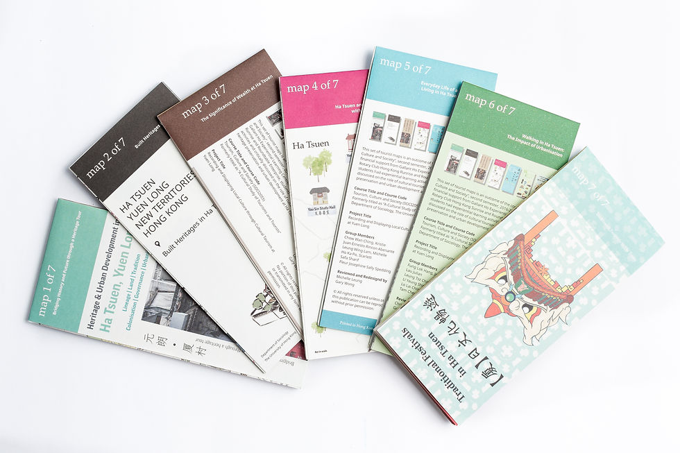
A set of 7 pocket-sized maps.

7 Maps provide tourists both cultural tour route in Ha Tsuen and relevant historical facts.

Simple map routes are provided together with the cultural and historical facts.

Tourist attractions and transportation are pinned on the map.

Tourists can travel around and understand more about Ha Tsuen with the map.

Scenery of Ha Tsuen from now and then are provided.
Heritage & Urban Development in Ha Tsuen, Yuen Long:Bridging History and Future Through a Heritage Tour
總編輯:黃培烽
合作夥伴:香港大學社會學系
紙本規格 Book specification
A set of 7 tourist maps
Full-colour
160mm x 70mm (folded)
English
Geography, Travel & Maps/ History of Hong Kong
這是一套由大學生的課程專題製成的地圖,而課程為香港大學社會學系於2016-2017年度第二學期開設的「旅遊、文化與社會」。透過香港大學何耀棣體驗學習中心、香港旭日扶輪社和Roundtable Enterprise的財政支援,讓學生從體驗中學習,更能對文化旅遊在「厦村古蹟保育和可持續城市發展」中的角色作出批判性的討論。以下六個主題之旅分別以七個不同切入點介紹厦村:
地圖1: 古蹟之旅——歷史與未來的橋樑
地圖2: 厦村的文物建築
地圖3: 厦村的財富與其重要性
地圖4: 厦村與歷代政府
地圖5: 厦村少女的生活日常
地圖6: 漫步於厦村:城市化的影響
地圖7: 【厦】日文化暢遊
Chief Editor: Gary Wong
Collaborator: Department of Sociology, The University of Hong Kong
This set of tourist maps is an outcome of the course “Tourism, Culture and Society”, second semester, 2016-2017, offered by Department of Sociology, the University of Hong Kong. With financial support from Galant Ho Experiential Learning Centre, Rotary Club Hong Kong Sunrise and Roundtable Enterprise, students had experiential learning activities and critically discussed on the role of cultural tourism in heritage preservation and sustainable urban development at Ha Tsuen. The six theme tours below introduce Ha Tsuen from seven different perspectives:
Map1: Bridging History and Future through a Heritage Tour
Map2: Built Heritages in Ha Tsuen
Map3: The Significance of Wealth in Ha Tsuen
Map4: Ha Tsuen and Its Relationship with the Governments
Map5: Everyday life of a Teenager Girl Living in Ha Tsuen in the 1960s
Map6: Walk in Ha Tsuen: The Impact of Urbanisation
Map7: Traditional Festivals in Ha Tsuen
You might also like...
